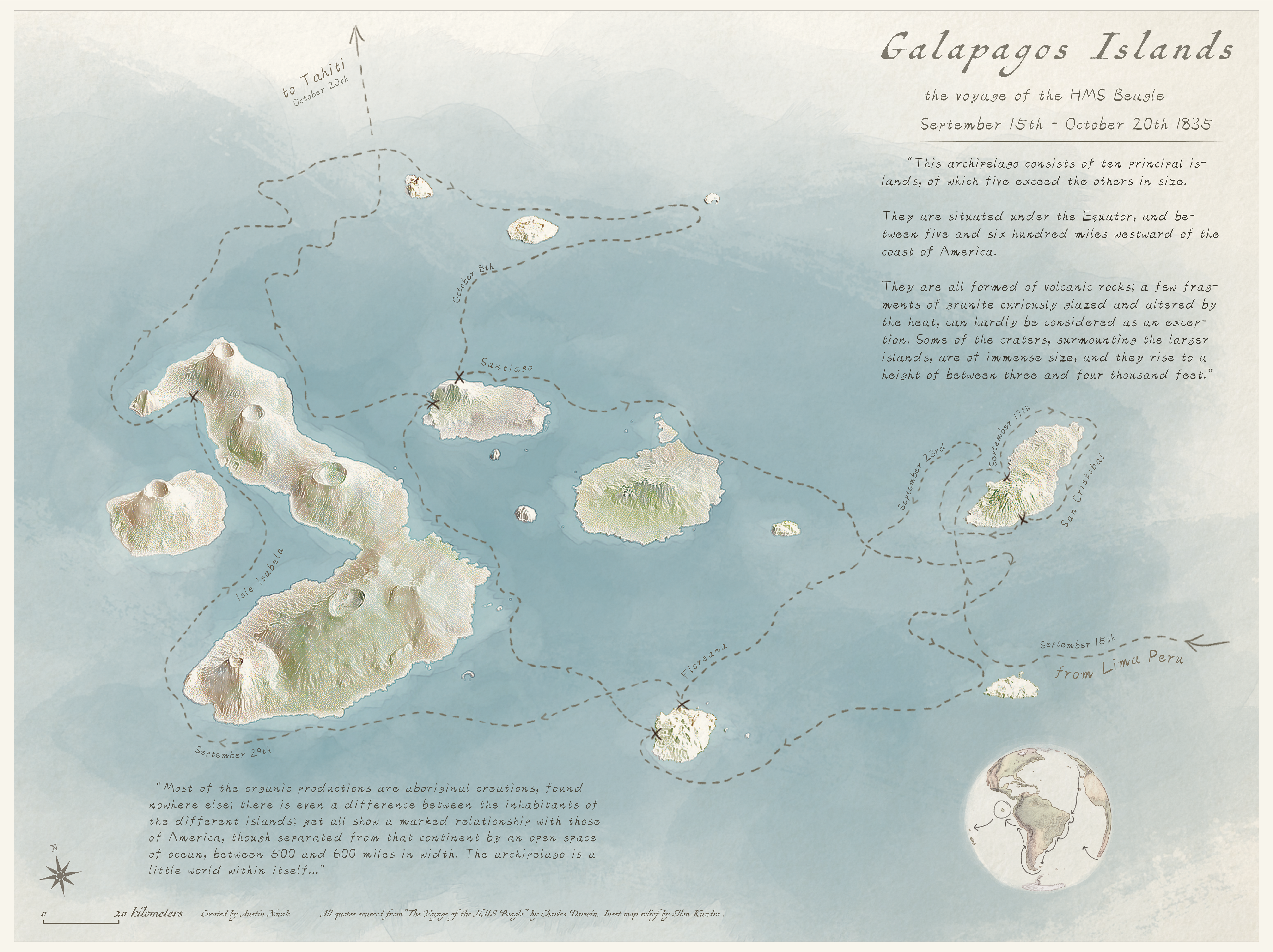
This map depicts the route taken by Charles Darwin's ship, the HMS Beagle, on his visit to the Galapagos Islands. As my final project for my graphic design in cartography class, I had liberty to design and style the map exactly how I envisioned it. I pictured a handmade and heavily stylized depiction of the islands, with terrain that looked more sketchy and painterly than other relief maps I had made. I had this idea that an oblique perspective would make the visuals of the islands more compelling, giving them a greater sense of grandeur and wonder. There's a sense of scale that I feel like is associated with uncharted islands and sailing ships that deserved to be properly represented, even if it's heavily influenced by things like "The Pirates of the Carribean" film saga which I definitely thought of myself.
Creating the map had several tall obstacales that proved challenging to hurdle. I had to work with lower resolution elevation data and use photoshop to upscale the DEM and later sharpen and further tweak the final render. Finding the right perspective to best depict the islands was challenging and I had to learn how to apply my blender skills to a different syle of render. Matching the painterly, sketchbook feel of the map involved a lot of experimentation with brushwork and different masks, but overall combined with illustrator based typography my original vision was brought to life.